This project utilises the Zambezi River’s natural flow for electricity, adapting to seasonal changes to generate sustainable power.
Power Output and Energy Production
All hydroelectric power stations generate electricity proportional to the flow of water through their turbines and the difference in height of the water between the turbine inlets and outlets, which is known as the head.
As a run-of-river hydroelectric power station the Ngonye Falls project will only be able to use the flow of water available in the river at any given time. There are no dams or reservoirs where water can be stored and used at a later time to add to the river flow.
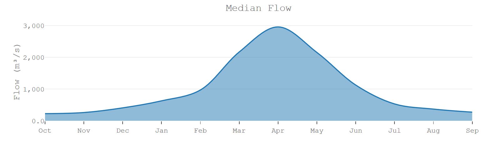
The flow of water in the Zambezi is highly seasonal with a peak of flood flows between March and May from rainfall in the upper catchment, and lower flows in the remainder of the year, the lowest flow being between September and November.
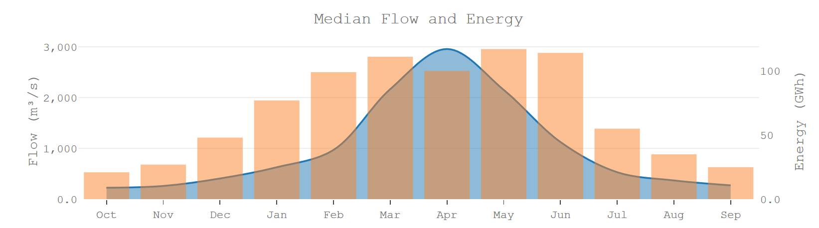
As the flow of water in the river varies through the year so the electricity production also changes. The months with the highest average energy production correspond to the months with the highest average (or median) flow. The maximum rate of energy production at any time is limited by the size of the canal and the turbines which set the 180MW capacity of the power station.
An unusual feature of the Ngonye Falls project is the variation in generation head through the year caused by water levels in the narrow downstream gorge varying, depending on the flow in the river.
During flood flows the downstream gorge floods with water, the water level at the turbines rises and the head available for power generation drops.
Because the head increases during drought conditions, when there is less flow, the power station generates more electricity than would be expected during drought years.
Hydrology Risk & Energy Security
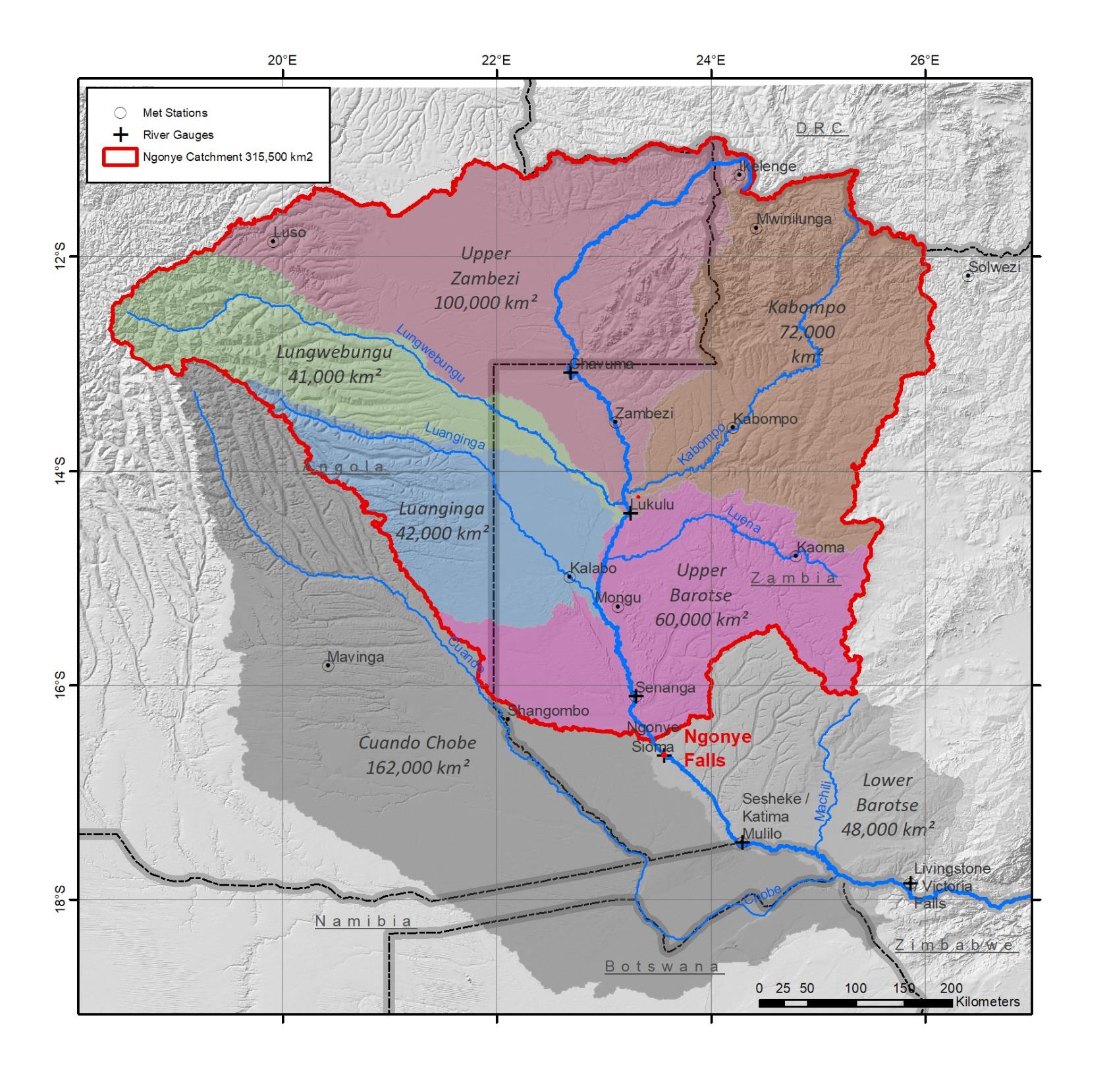
The Ngonye Falls Project has a very large catchment area upstream of all other dams and hydropower stations.
The catchment covers nearly 6 degrees of latitude north to south and 7 degrees of longitude east to west encompassing a range of climate and rainfall zones.
There are no other dams upstream of the project and no significant agricultural or industrial extraction of water.
The Bartose Floodplains upstream of the project act as a buffer, smoothing the flow downstream.
The Ngonye Falls Project has a low hydrology risk:
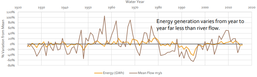
Large catchment size and the effect of the Barotse Floodplains leads to stable and predictable output.
100 years of daily flow records for the Zambezi river allow for detailed modelling and a high degree of confidence in forecast energy production.
Unique hydraulic conditions mean that power output is maintained at relatively high levels even in drought periods.